
Emma Gorge to Broome (5.5 days)
Photo albums from the trip (more photos than shown on this page): Days 22-24, Day 25 (Geike Gorge), Day 25 (Fitzroy Crossing), Days 25-26 (Derby).
These notes were written by Eric and occasionally amended by Jean. Eric took some of the photos and Jean took others. All photos were selected, cropped, and inserted into this file by Jean. Factual information was taken from various sources including tourist brochures; we do not guarantee its accuracy.
Click on a photo to see a full size version. Not recommended for readers on dialup connections — some of these files are between 1 and 2 MB.
Day 22, Emma Gorge to Halls Creek, via Wyndham, Saturday 26 June 2004
We drove off in the very early morning, before breakfast. We carry breakfast cereal, but we couldn’t get fresh milk in the park (the resort kitchen was running low), and unlike most accommodation in Australia, the tented cabin didn’t have a fridge.
So, back over the Gibb River Road 25 km to the Great Northern Highway, then 50 km further north to Wyndham (pop 1000, map ref. 21). It was very obviously low tide, and so you could see extensive tidal flats, and were greeted by a wide range of mosquitos.
Near the modern and extensive police station, we found the town hotel, where we got a filling cooked breakfast. The person on duty told us they were very busy with unusually large numbers of tourists. When Eric paid our breakfast bill, he was told that the community club we had passed on the way into Wyndham had been broken into 14 times in the same number of weeks. There had been a slight delay in entering the bar area to pay, as the owner had taken to keeping his two bull mastiff dogs in the bar area overnight. (“They prefer to sleep indoors anyway.”) He hadn’t had any break ins.
Our main purpose in driving all the way to Wyndham (apart from breakfast) was to refuel, but it gave us a good excuse to look around the town.
Despite the port town not being all that large, we counted no less than four cemeteries: the Afghan cemetery dating from the 1890s camel drivers; the Pioneer cemetery from 1886 to 1922, which covered the meatworks period; the Gully cemetery from 1922 to 1968; plus the present cemetery. We guess it was an unhealthy place to be in the early days.
Being on the coast, Wyndham was visited early by Europeans, with the first landing at View Hill in 1819. However the port was not established until 1885, and named by John Forrest after the eldest son of Lady Barker (wife of Sir Frederick Napier Broome, governor of West Australia). Gold discoveries at Halls Creek in 1884, and development of cattle stations by the Duracks in the 1880s helped push the population up to a peak of 5,000, but by 1906 it was down to 50 Europeans. The port is now used for live cattle transport, export of live goats, and export of Ord River sugar to Indonesia. The population of about 1200 is about half Aboriginal.
 Before we left town, we stopped to again take photographs of Jean with large animals — this time a 20 metre crocodile made from 5.5 km of steel rod, welded with 50 kg of welding rod, lots of bird mesh, and covered with 5 cubic metres of concrete.
We decided not to visit Parry Lagoon Nature Reserve, on a dirt road, starting some 15 km south of Wyndham, although it sounded like an interesting place. Marlgu billabong is reported to be a great bird watching spot, with boardwalk and some hides near the car park, but we really aren’t bird watchers. The nearby Parry Creek Farm offers private cabins and rooms, and specialises in powered sites for caravans and campers by a billabong.
 About 40 km along the Great Northern Highway, we turned onto a side road to drive the few kilometres to the Grotto. This is a large sinkhole in rocky country leading down to a deep waterhole. Apart from the views from the top, there are around 100 steps built in the rocks to assist you in reaching the mostly shaded bottom.
About 60 km south from Wyndham, we reached the Broome turnoff on the Great Northern Highway. We did lots of fast kilometres on this good road.
We stopped at Doon Doon road house, where they are busy building an amenity block for a caravan park, and hope to someday include motel units. We again saw the retired bicyclist we had seen at Victoria River Crossing some considerable time before. He was from Townsville, and was headed for Broome and Perth. He told of being stuck by the road for several hours with a broken wheel, and with his tools being unable to shift his gear cluster so he could make repairs. He eventually accepted a life into Kununurra, where he ended up staying at a caravan park for several days, even after the local garage used an air tool to undo his gear cluster so he could repair his wheel.
 We next stopped at the Turkey Creek roadhouse, where there were artistic drawings on the rocks outside the roadhouse. To my considerable amusement, the Turkey Creek roadhouse had game burgers with crocodile, emu, kangaroo, camel, but no turkey! You can take helicopter flights to the Bungle Bungles from here. This area is the site of the Warmun Aboriginal community, who have an art centre open to visitors.
At Leicester’s Rest, 100 km from Halls Creek, there was a 24 hour stopover area, which had pit loos and lots of isolated camping areas. Although there are no other facilities, this is for 24 hour stops by self contained caravans and campers. It was on what appeared to be the old highway, and was close to some pleasant looking river areas.
We reached Halls Creek (pop 4000, latitude 18.13S, 127.40E, map ref. 22) around 3 p.m. The Comfort Inn motel on a side street looked somewhat the worse for wear, with a broken sign, and large savage looking fences. We thought it might even be derelict, but a lot of other places were stoutly barricaded and appeared very thoroughly locked up. We went back to the main street, and took a room at a Best Western.
There’s not much food to be found in Halls Creek when you arrive mid afternoon on a Saturday. The various supermarkets were mostly closed. Some that were open, like the Coles Express at the Shell garage, had a range you could fit inside a Volkswagon. I got milk and orange juice for the morning at a garage store.
I talked to a long distance woman cyclist, around our age, who was seeking a public phone that would accept a 1800 number (public phones are not always easy to locate in these towns). She had set out from Gympie in south east Queensland last year, and gotten a job and stayed over in Alice Springs when the weather got too hot. She had set off again in May this year, and was headed for Broome. We are increasingly impressed (and somewhat intimidated) by the 60-plus crowd doing adventurous and athletic things like bycyling around Australia on their own!
We had a splendid dinner at the motel at Halls Creek. Great steak, with the best meat we have had this trip (except at El Questro), excellent correctly cooked vegetables, and potato wedges. Plus a cleanskin cabernet merlot at a very reasonable $4 a glass price. We liked it so much we bought a $15 one litre bottle “for Ron” (late ‘R on). Jean apparently hadn’t heard that expression previously.
Jean was able to collect her email via her CDMA cell phone, but again the motel had no phones in the rooms. To my considerable surprise I had a GSM cell phone connection in Halls Creek, so I imagine that technically I could also have collected email.
Day 23, Halls Creek, Sunday 27 June 2004
We decided we were taking a rest day, so Jean could catch up somewhat with her various book deadlines while we had a desk for the computers, and lots of power points. We also did laundry and similar catch up tasks, like expanding these notes. Alas for the laundry, while it was drying, someone nearby started a smoky fire, so the dry clothes smelled strongly of wood smoke.
Day 24, Halls Creek to Fitzroy Crossing, Monday 28 June 2004
 Jean remembered visiting this town on her 1979 bus tour, and insisted that we drive out to Old Halls Creek. We took Duncan Road, which rapidly became the 16 kilometre dirt road to the old town, where scant remains of building sites are on both sides of the creek. In 1885, this was the site of the first gold mining town in West Australia. The old post office building is partly protected by a new roof, covering much the area of the old one, plus wire mesh to reduce vandalism. (The roof and mesh weren’t there in 1979.) There is a small, antique appearing caravan park here, and even a restaurant, in an area for those seeking something off the main routes.
 About six kilometres from town we diverted through a gate to another dirt road leading to the China Wall. This natural quartz vein formation stretches over considerable lengths of the countryside, and the better examples look very like the ruins of an artificial wall.
We viewed various statues in Hall Creek upon our return. These included Russian Jack, who wheeled a companion in a wheelbarrow many kilometres to help.
Also in this area is the Yarliyil community based art centre, which originally opened in 1992 in a woman’s safe house, but now has more space. Another local initiative at Halls Creek and Fitzroy Crossing is the Kimberley Language Resource Centre, which has worked since 1985 to preserve some indigenous languages. They produce interactive CDs about some traditional crafts, in some of the 30 original languages of the area (Nyikina, Katatja, Bunuba, Walmajarri, Kija).
One thing we did miss doing was taking a scenic flight over the 850 metre wide 300,000 year old Wolfe Creek meteorite crater on the edge of the Tanami Desert. The Jaru and Walmajarri people know the crater as Gandimalal. The crater walls still extend 35 metres high, while the floor is 20 metres below the surrounding countryside, filled in by sand from its estimated 120 metre original depth. Driving there means a 132 km drive down the Tanami track, and we thought that would be a bit too rough for us. Oasis Air and Northwest Regional Airlines both had light plane flights. Jean had been there in 1979, because the bus tour came up the Tanami track from Alice Springs, but she hadn’t seen it from the air.
The very helpful staff at the tourist centre had an excellent kit of flyers prepared for visitors to the area. Jean located a really nice eatery in the same building, and we get home made chicken and salad rolls with home baked rolls to take with us for lunch. There are no roadhouses until the next town, and that was too far to reach before lunch.
The Telecentre is in the library, where much renovation work was happening. They didn’t have a way to allow us to plug our laptops into their network, but would let us connect to a phone line. Except the phone lines are at present just bare wires!
The public toilets were the fully automated, singing variety with push button doors and integrated liquid soap, water, and hot air dispenser over the wash basin. We had encountered these before at Ayr (a country town 200 km north of our home), and also in that cultural centre for high tech, San Jose in Silicon Valley. However the San Jose one didn’t sing, and you had to feed it a quarter (25c) before it would open its door.

 Good stretch of wide, well marked road as we headed for Fitzroy Crossing. There are no towns or roadhouses, only a few rest areas. The Mary Pool rest area 110 km down the road (latitude 18.43S, longitude 126.52E) was beside the river, and was very pleasant looking. Caravans could stop for 24 hours, although the only facilities are pit toilets and barbecue areas.
Along the road we saw the woman bicyclist I had spoken to in Halls Creek. She was making a steady pace.
 Ngumban Cliff rest area gave a wonderful view of the road and the surrounding countryside. It was less distant from Mary Pool than we had expected.
We had heard the town of Fitzroy Crossing (pop. 1500, latitude 18.12S, longitude 125.34E, map ref. 23) has one fancy and expensive resort with rooms overlooking the river, and one caravan park also overlooking the river, where the pub is popular with the Aboriginal population. We discovered a third (relatively new) place to stay. We learned later that the pub (the Old Crossing Inn) has regular motel rooms as well.
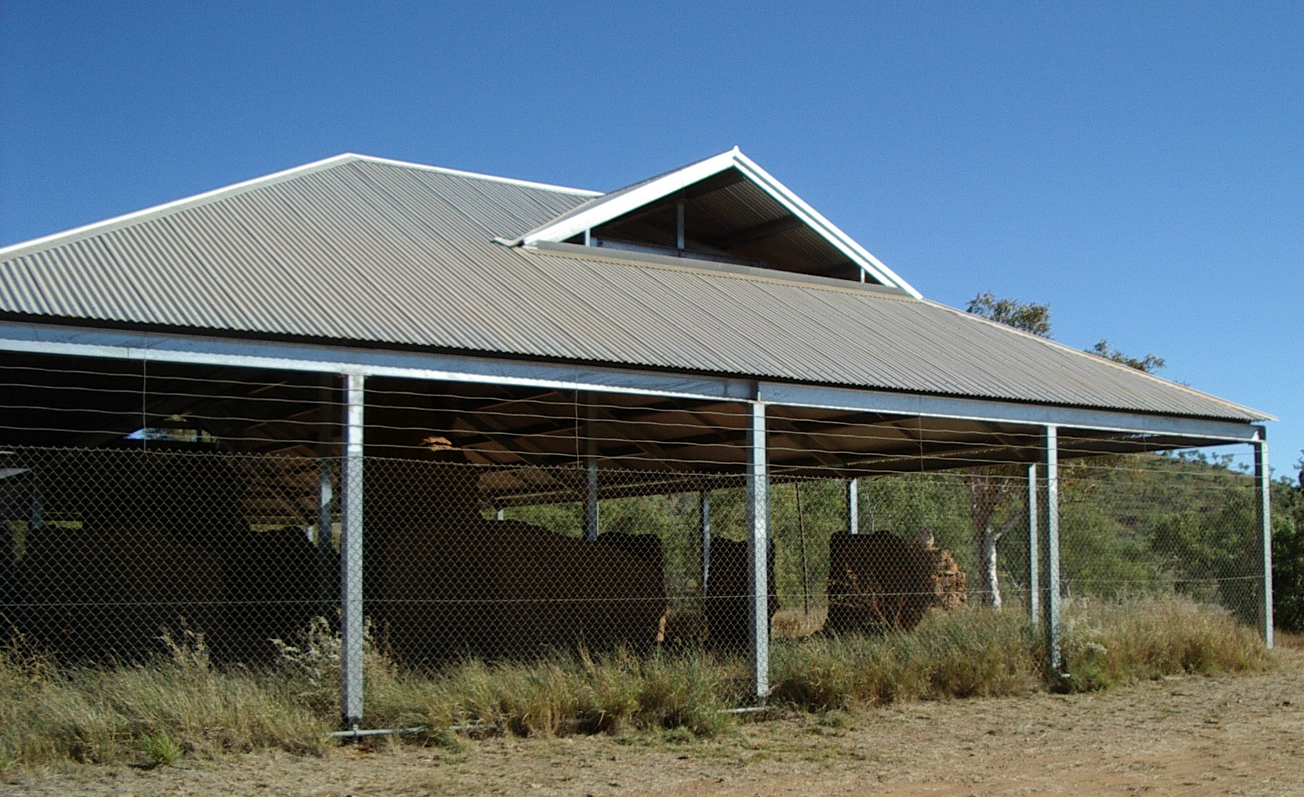
 We took a self-contained (kitchen and ensuite) room on stilts, in the caravan park close by the Tarunda supermarket. During the Wet season, they often get quite high flood water here in town, hence the need to build things up off the ground. The room was comfortable enough, the beds especially, but had few convenient power points, the lights were not bright, and the room had nothing that could be effectively used as a typing table.
Day 25, Fitzroy Crossing to Derby, Tuesday 29 June 2004
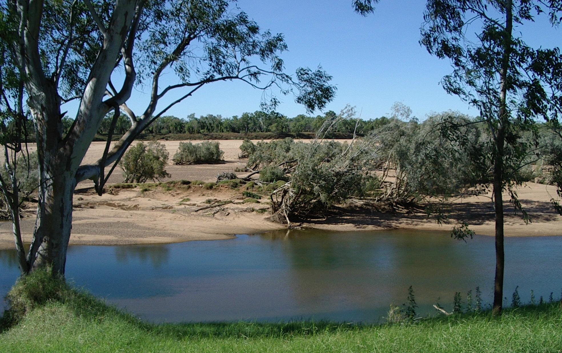
 We were up before 6 a.m. and drove off 18 km (on what is now a paved road) to Geikie Gorge National Park for an 8 a.m. Conservation and Land Management (CALM) boat ride through the narrow rocky section of the Fitzroy River. While waiting for the tour to start, we noted the flood height levels marked on the shelter.
 The flood height through the ancient coral reefs is certainly impressive. The cliffs showed white marks far above us, where wet season waters rushed and scoured the rocks clean each year.
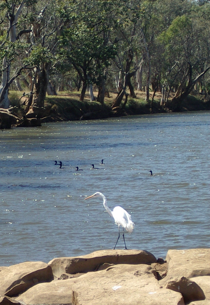
We were told the wet season current flow in the Fitzroy was second only to the Amazon. The rock walls are carved into fantastic shapes, and look like they should fall at any moment.
We saw the usual crocodiles and birds. The crocodiles are (mostly harmless) freshwater types, as at over 300 kilometres from the sea, estuarine crocodiles have not been sighted.

 There is also a more expensive half day Darngku (pronounced darn-goo) heritage trip, including walks. The stories about the gorge mostly come from Darngku family of the Bunuba tribe.
Back in town we sought the original Fitzroy Crossing location but failed to find it. We did take a closer look at the Crossing Inn, which had Aboriginal art on the outside walls. The pub was just opening for the day, and Jean decided this is the place she stopped at on her 1979 bus tour.

 We visited the Pioneer cemetery by the riverside. This is so close to the river that I’m surprised it hadn’t flooded at times. Some graves were marked with elaborate metal work made from old tools. We recognised animal traps on one, but couldn’t identify the antique tools on another.
Then we set off west again, headed for Derby. We took a few brief stops at rest areas during the drive. Our lunch stop was under an ancient boab tree, at the second rest area we encountered. The only facilities there were some picnic tables, and the shade of the enormous boab.
 It seemed a long, boring drive to Derby (pop 5000, latitude 17.19S, longitude 123.39E, map ref. 24). We booked into a fancy room (one with a phone) at tourist prices, at the King Sound Resort Hotel. This looked out on the swimming pool (which was in the centre of the hotel, surrounded by rooms). We noted four people our age aggressively relaxing by the pool, with books and drinks. We came and went several times during the afternoon, and they did not appear to have moved during that time.
At the Derby Visitor Centre we got the usual local tourist information and details of tide times for today and tomorrow. Derby has the second highest tides in the world, and on Wednesday, the times were right for seeing both the high and the low tide. It was also close to a full moon, which gives the best tide results (we were aiming to be in Broome on the night of the full moon).

 At the news agency, we asked the real character behind the news agency counter which day the Tuesday Australian would arrive. To our astonishment, she said Derby was the last place this far north where the papers arrived on their day of issue. Indeed, the papers arrived while we were talking. We were later amused to hear the newsagent arguing with a customer about it being cold (the customer said it wasn’t). The newsagent thinks below 25C in the daytime is low, and below 15C at night is cold. She had been getting 13.6C on her veranda the previous night. We agreed that 13.6C is cold.
We crossed Clarendon Street to visit the Telecentre, which shares premises with a regular computer shop called RB69. They said we could connect our notebook computers to their network, for $9 an hour.

 Jean researched the hotel menu, and precisely at the six o’clock opening we turned up seeking barramundi. No such luck. Today they had a bus group in, so they were serving a buffet meal. Wasn’t a bad meal at all, just not what either of us had planned for. At 6:30 the bus group arrived, and we recognised people from the Outback Spirit bus we had seen at El Questro and Geikie Gorge.
Day 26, Derby, Wednesday 30 June 2004
We both spent most of the morning working on our computers, with Jean needing to catch up on her book revisions. Later we visited the jetty and bulk lead and zinc ore loading facility, timing our visit just prior to midday for high tide. Muddy water, and a tide over 9 metres. We returned just before sunset to take comparison photos with the tide on the way down to the 3 metre mark.
 There was a small botanical garden in the grounds of the local library. It was nicely laid out and had some interesting specimens, but it seemed to have suffered somewhat since it was installed a few decades ago, and nothing was marked. The library seemed a pretty reasonable community resource, especially given how hard it sometimes is to get resources in any remote area. Lots of displays on local history, culture, and flora and fauna, probably put together by school classes.
There are reef flights over the Buccaneer Archipelago and the horizontal waterfall (a thirty metre gorge where the tide squeezes through at 30 knots) by Reef Flight and by King Leopold Air. We decided not to take a flight, though usually Jean wants to go everywhere she gets a chance.
Day 27, Derby to Broome, Thursday 1 July 2004
After refuelling in Derby we visited the Boab Prison Tree and nearby artifacts from the early 20th Century like a water trough and windmill, a few kilometres outside Derby. Then 40 km back to the Great Northern Highway, which continues through Broome towards the south.
Willare Bridge Roadhouse, about 30 km from the Derby turnoff, had air conditioned rooms in the older style main building. Good prices, but with shared facilities. That was the first roadhouse we saw since Derby.
All the way along the Great Northern Highway we kept encountering single lane bridges. First would come an 80 kph speed sign, then a warning that a single lane bridge was ahead, then a No passing or overtaking sign. Since only a bicycle could fit alongside a car, this was more like a law of nature than a road rule.
We stopped briefly at the Nillibubbica rest area, about 40 km past Willare Bridge. This is another rest area with pit loos, and picnic tables, but nothing much else. All set in vivid green bushland, showing the seasonal tropical rainfall of this close to coastal area. We reached 5000 km travelled from home just before midday, still with 60 km to go to Broome.
We stopped again briefly at the Roebuck Plains roadhouse, 30 km from Broome, on the Broome Highway, just past the turnoff to the south.